← Home · Excavations

Geotechnical Design of Deep Excavations in Aylesbury's Floodplain Soils

Together, we solve the challenges of tomorrow.

DETAILS →

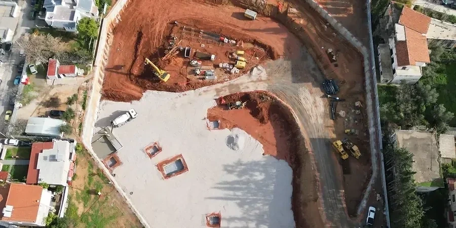
Aylesbury sits on a layered sequence of Gault Clay, Lower Chalk and alluvial deposits from the River Thame. Cut deeper than three metres and you almost always hit groundwater. The town centre redevelopment and the Berryfields expansion have pushed excavation depths into the 6-9 metre range, right where the chalk aquifer starts influencing stability. What looks like competent material at the surface often masks running sand lenses within the gravels. In our experience, designs that rely solely on desktop data without integrating in-situ permeability testing misjudge the phreatic line by metres. The local geology demands a soil-structure interaction model that respects the brittle nature of the chalk and the time-dependent settlement of the Gault. A thorough ground investigation backed by CPT testing helps map the transition between the dense gravel and the weathered chalk before any shoring scheme is finalised.

In Aylesbury, the difference between a dry excavation and a costly failure is knowing exactly where the chalk aquifer sits before the first bucket goes in.

Approach and scope

A recent project on Friarscroft Way involved a 7-metre cut for a two-level basement immediately adjacent to a Victorian masonry building. The initial boreholes showed medium-dense gravel over structured chalk. However, the monitoring data during the trial pit stage revealed a persistent wet seam at the gravel-chalk interface. The design team switched from a standard secant pile wall to a reinforced diaphragm wall with passive relief drains, verified through slope stability analysis of the temporary cut. This approach controlled lateral displacement to under 8 mm. Key considerations that shape our excavation designs in Aylesbury include:
Geotechnical Design of Deep Excavations in Aylesbury's Floodplain Soils
Technical reference image — Aylesbury

Site-specific factors

The Gault Clay that underlies much of Aylesbury behaves in a heavily overconsolidated manner. When you unload it at the base of a deep dig, the pore pressure equalisation can lag by weeks. This delayed heave has cracked floor slabs in several local projects where the design assumed drained conditions too early. The second major hazard is the chalk aquifer. It is confined beneath the alluvial silts in the town centre. A small window in the gravel layer can turn a manageable seepage into a blowout. We routinely specify standpipe piezometers at multiple levels and run time-dependent consolidation models for any cut exceeding five metres. Ignoring these two local mechanisms means accepting a risk profile that no insurer would underwrite for a basement in Aylesbury.

Need a geotechnical assessment?

Reply within 24h.

Email: contact@geotechnical-engineering1.com

Technical parameters


ParameterTypical value
Typical excavation depth range3.0 m to 12.0 m below ground level
Design standardBS EN 1997-1:2004 + UK National Annex
Groundwater encountered1.5–3.5 m bgl in alluvial zones
Chalk UCS (typical)0.8–4.5 MPa depending on weathering grade
Lateral wall deflection limit< 0.2% of retained height for sensitive structures
Dewatering methodDeep wells with vacuum assistance in silty layers
Analysis approachWinkler spring models and 2D/3D FEM (Plaxis, Wallap)

Related technical services

01

Temporary and Permanent Works Design

From king post walls for trench cuts to fully propped secant pile boxes, we produce construction-ready drawings and calculation packages. Each design is checked against BS EN 1997 DA1-C2 and includes detailed dewatering staging.

02

Construction-Phase Monitoring and Review

We install inclinometers, piezometers, and vibration monitors around the perimeter. Weekly review reports compare actual deflections against the trigger values set in the design, allowing real-time adjustment of prop loads.

Relevant standards


BS EN 1997-1:2004 (Eurocode 7: Geotechnical design), BS 8002:2015 (Code of practice for earth retaining structures), CIRIA C760 (Guidance on embedded retaining wall design), BS 5930:2015+A1:2020 (Code of practice for ground investigations)

Q&A

What is the typical cost range for a deep excavation design package in Aylesbury?

For a residential basement or small commercial cut, design fees typically fall between £1,580 and £6,650 depending on depth, proximity to neighbouring structures, and the complexity of the groundwater control required. Larger infrastructure cuts are scoped individually after the desk study.

How does the chalk affect excavation stability in Aylesbury?

The chalk is fractured and water-bearing. Stability is controlled by joint spacing and infill material. Grade III chalk can stand near-vertically in short-term cuts, but once water moves through the fractures it degrades rapidly. Our designs always include a face treatment specification for chalk exposures lasting more than 48 hours.

Do I need a retaining wall or can I batter the excavation?

Battering is possible on greenfield sites if you have the space and can manage surface water. In Aylesbury's urban plots, setbacks are tight and the Gault Clay needs a slope no steeper than 1:2.5 for long-term stability. Most town-centre projects end up needing a vertical retention system.

How long does the design and approval process take?

A typical basement scheme in Aylesbury takes four to six weeks from receipt of a compliant ground investigation to issuing the final construction package. This allows for finite element modelling, internal peer review, and any dialogue with Building Control regarding departures from standard details.

What is the biggest geotechnical risk for a deep excavation here?

Uncontrolled water inflow. The chalk aquifer is confined under the alluvium in parts of the town. A single unsealed investigation borehole can provide a direct path for water to flood the dig. We always recommend grouting up legacy boreholes within the zone of influence before excavation starts.

Location and service area

We serve projects across Aylesbury and its metropolitan area.

View larger map
div>